Course Maps
Course Map · Boston, Massachusetts, USA
Head of the Charles Course Map
The iconic 3-mile upstream course along the Charles River, passing under six bridges with two decisive turns at Weeks Footbridge and Eliot Bridge. One of the world's largest rowing events, hosting over 11,000 athletes annually.
Course Details
- Distance
- 3 miles (4.8 km)
- Start
- Just below the BU Bridge, near BU's DeWolfe Boathouse
- Finish
- About 0.5 miles past Eliot Bridge
- Bridges
- 6, plus the 90° Weeks turn and the Big Turn into Eliot
- Water
- Flat basin above the Charles River Dam, wind is the main factor
Maps
Click a map to open it full size.
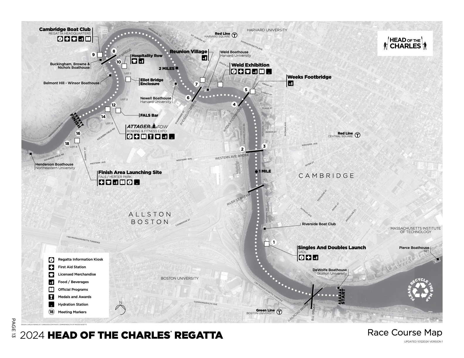
Official HOCR Course Map
The race-day course from the HOCR Athlete Guide.
Added
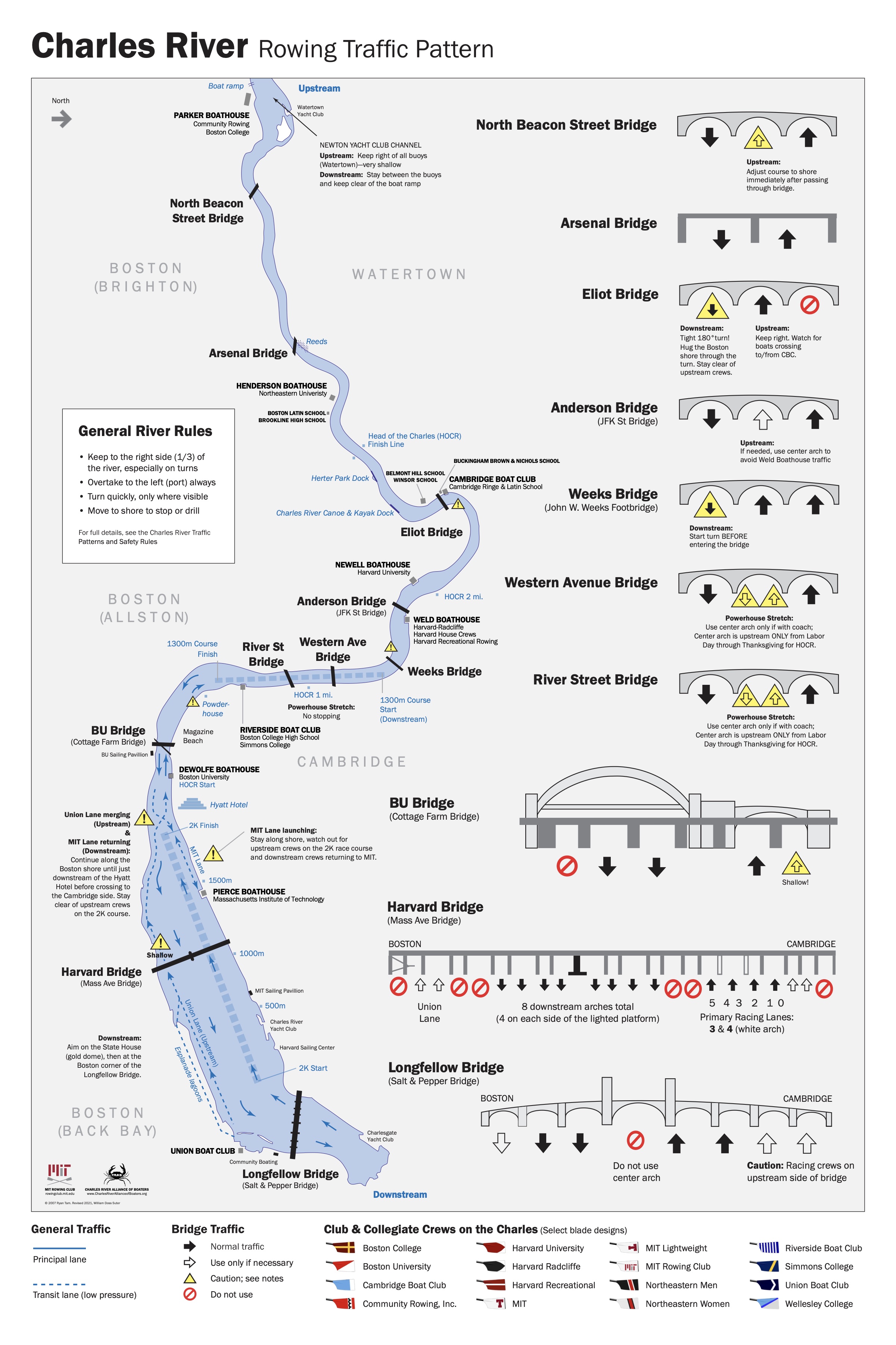
Charles River Rowing Traffic Pattern
Everyday traffic rules for practice on the Charles, with arch-by-arch guidance for every bridge on the HOCR course.
Added
Course Strategy & Key Points
Critical Turns
- Magazine Beach - first bend to starboard, follow the green buoys
- Weeks Footbridge - 90° turn to port, roughly halfway
- Big Turn - long turn to port from the 2-mile mark into Eliot
- Final bend - to starboard after Eliot, stay close to the buoys
Bridges in Order
- BU Bridge - just after the start
- River Street Bridge - Powerhouse Stretch
- Western Avenue Bridge - just after the 1-mile mark
- Weeks Footbridge - the 90° port turn
- Anderson Bridge - just before the 2-mile mark
- Eliot Bridge - about 0.5 miles from the finish
Track Your Performance with CrewSpeed
Use CrewSpeed's GPS tracking to monitor your speed through each section of the course, analyze your turns, and improve your race strategy for this challenging course.